

The National Weather Service has issued flood advisories, high wind warnings, and winter storm warnings throughout Northern California.
Cities from San Francisco, San Jose, Sacramento, Blue Canyon, to Lake Tahoe are being hit by strong winds and heavy rain and snow as an atmospheric river storm makes its way through the Golden State, bringing several inches of rainfall and a chance of thunderstorms, according to the National Weather Service.
The storm, which appears to be the strongest to California in several months, signals what’s forecast to be a long, rough winter for the state, driven by a strong El Niño that continues to strengthen in the Pacific, according to the National Weather Service.
“These systems pull in strong amounts of moisture from the eastern Pacific, and they really deepen in that area and move onshore through California,” said Jacob Fender, a NWS meteorologist.
“They help produce higher rainfall rates, higher snowfall rates across most of the area, and result in the heavy, wet snow, especially in the Sierras.”
Weather advisories in the San Francisco Bay Area
Days before Wednesday’s storm, the NWS had issued several high surf advisories for the San Francisco Bay region as waves crashed against the shoreline, but as the storm hit landfall on Nov. 18, the NWS issued multiple advisories for the area.
Notably, early Wednesday morning, the NWS issued a wind advisory for the region until 4 p.m., as cities in the Bay are expected to see winds of 20 to 30 mph with gusts up to 55 mph. The advisory affects San Francisco and San Francisco Bay Shoreline, the Central Coast, the Santa Clara Valley and Eastern Hills, and the Santa Cruz Mountains.
Additionally, the NWS issued a flood advisory until 3:30 p.m. throughout the Bay Area, as excessive rainfall may lead to “minor flooding in low-lying and poor drainage areas.”
Meteorologists with the National Weather Service warn commuters to allow extra time to reach their destination, as “some roads may be closed” due to flooding and high waters.
These conditions have also affected vehicle services like Waymo, which paused services for the rest of the day after San Francisco emergency personnel responded to a Waymo autonomous vehicle stalling in the middle of a road in the Panhandle, according to San Francisco Supervisor Bilal Mahmood.
Although the rainstorm is expected to lighten up by this afternoon, it is expected to return tonight and continue into late Thursday night, according to the National Weather Service.

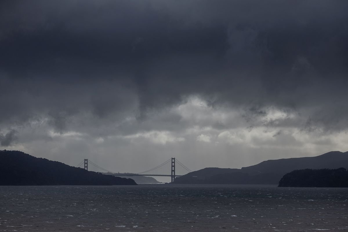
Darks clouds are seen over the Golden Gate bridge as a Pacific storm known as an “Atmospheric River” approaches northern California, bringing heavy rains and winds that could trigger widespread flooding, in San Francisco, California, U.S., February 4, 2024. REUTERS/Carlos Barria
As a result, the National Weather Service is extending its Coastal Flood and High Surf Advisory until 10 a.m. on Nov. 20.
As of 2 p.m., the National Weather Service noted that downtown San Francisco had received about 2.18 inches, close to the historical day-of-record total of 2.24 inches recorded in 1918.
Sacramento Valley and Sierra Mountains
Like the San Francisco Bay Area, the National Weather Service issued several advisories for the Sacramento Valley and Sierra Nevada mountain regions as heavy rainfall moved through the valley.
Specifically, the NWS issued a flood advisory for the Delta and southern Sacramento Valley, which has received moderate to heavy rainfall and is expected to continue through Thursday.
Additionally, the NWS forecasts a chance of thunderstorms, small hail, and potential funnel clouds developing in the Sacramento Valley region throughout Wednesday and Thursday.
As the rain moves toward the Sierra Nevada and Tahoe region, National Weather Service meteorologists warn that travel will be heavily impacted by the sudden snowfall.
Fender noted that as rain from the Sacramento Valley moves into the Sierra region, it is expected that the rain will help produce one to two inches of snow per hour.
“That will help reduce the visibility drastically, and then combine that with the strong winds we are seeing, you’re going to get those significant reductions in travel,” Fender said.
Notably, Caltrans closed a portion of I-80 after the highway saw several spinouts due to harsh mountain snow conditions.
“Slow down! Nobody wants to be the reason an entire interstate shuts down,” reads a social media post from Caltrans District 3.
By 2:40 p.m., Caltrans prompts restrictions on semitrailers from traveling on I-80 in several Nevada and Sierra counties.
This article originally appeared on USA TODAY: High winds, floods, snow: Northern California battered by storm












Leave a Reply