
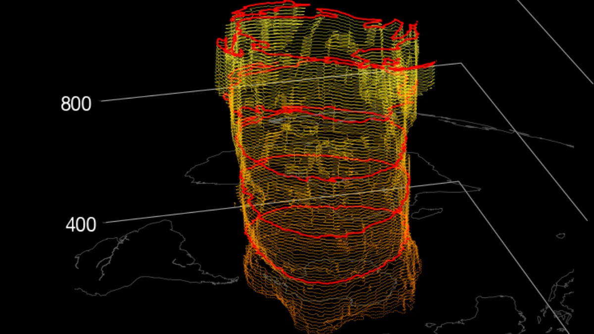
The Northern Hemisphere stratospheric polar vortex returned to westerly circulation over the Arctic in late August 2026 and strengthened through the first half of September as the region entered its normal seasonal cooling phase.
NASA data show zonal-mean winds at 60° north and 10 hPa reaching 10.40 m/s (23.3 mph) on September 15, above the 8.10 m/s (18.1 mph) climatological mean for the date, while seasonal guidance analyzed by Severe Weather Europe shows a possible weakening during January and February 2027.
NASA Ozone Watch data show the zonal-mean wind at 60° north and 10 hPa changing from −0.10 m/s (−0.2 mph) on August 22 to +0.42 m/s (+0.9 mph) on August 23 before strengthening through early September.

The September 15 value was based on NASA’s GEOS Forward Processing assimilation system and compared with a 1978/1979–2025/2026 climatology. NASA uses GEOS Forward Processing data for the current season while the observations are incorporated into its MERRA-2 reanalysis.
The return of westerly winds is part of the normal seasonal development of the Northern Hemisphere polar vortex. As solar heating decreases over the Arctic, the polar stratosphere cools, and a ring of westerly winds strengthens around the region.
NASA describes the vortex as the cold air poleward of the strong stratospheric jet stream. Stronger circulation generally increases the isolation of Arctic air from the mid-latitudes, while atmospheric waves can distort the vortex and increase mixing.
Severe Weather Europe’s September 16 analysis shows further cooling around the North Pole in an ECMWF 14-day forecast at 10 hPa, approximately 30 km (18.6 miles) above the surface. A separate geopotential-height analysis shows a closed low already established over the polar region.
Late-September guidance presented in the report deepens and expands the low while developing a more organized ring of stratospheric winds around it. The analysis describes the circulation as slightly stronger than normal for the time of year, with extended-range guidance returning it closer to climatology during October.
Seasonal guidance shows possible mid-winter weakening
The longer-range signal differs from the normal early-season development. ECMWF seasonal output presented by Severe Weather Europe shows a stronger vortex early in winter followed by a marked reduction in 10 hPa zonal winds beginning around January.
The ensemble mean falls below the long-term reference and the model climatology during January and February 2027. A corresponding product shifts from negative geopotential-height anomalies over the polar stratosphere early in winter toward positive anomalies around January, which the report interprets as consistent with a weaker or more disturbed vortex.
UK Met Office seasonal output presented in the same analysis also shows weaker westerly circulation during the middle and latter part of winter. Copernicus Climate Change Service confirms that its seasonal service includes both ECMWF and Met Office forecast systems and provides zonal-mean zonal wind at 10 hPa and 60° north as a dedicated diagnostic.
The January–February signal is therefore reported as Severe Weather Europe’s analysis of Copernicus seasonal guidance. It is not an independently verified official statement that ECMWF or the Met Office expects a sudden stratospheric warming, vortex split or collapse.
Copernicus cautions that seasonal forecasts describe broad probabilities and circulation tendencies rather than day-to-day weather months in advance. Uncertainty increases with lead time, and the output can change with each monthly update.
A weakening signal is not a sudden stratospheric warming forecast
Zonal-mean wind at 60° north and 10 hPa is one of the main diagnostics used to track the winter stratospheric circulation. Positive values indicate westerly flow, while falling values indicate weakening westerlies.
A major mid-winter sudden stratospheric warming is commonly identified when those winds reverse from westerly to easterly, accompanied by rapid warming and major disruption of the polar circulation. A reduction in the seasonal ensemble mean does not meet that threshold.
Severe Weather Europe also notes that an actual wind reversal cannot be forecast for a particular week from a September lead time. The current output indicates a possible weakening regime, not a forecast of a specific major sudden stratospheric warming.
The previous winter showed how an event-scale disruption evolves. On February 7, we reported rapid Arctic stratospheric warming, strong vortex deformation, and ensemble guidance indicating a possible split.
Another warming developed later in February. On February 27, we reported that a wind reversal and final vortex split were forecast for early March. By March 5, diagnostics confirmed that the wind at 60° north and 10 hPa had reversed to easterly flow as the vortex split into two lobes.
Major vortex disruptions can alter surface circulation when stratospheric anomalies descend into the troposphere, but the regional response varies. High-latitude blocking and a more amplified jet stream can increase the probability of cold-air intrusions into parts of the mid-latitudes without guaranteeing severe cold in any particular region.
An Eos report published on September 16 described a late-April 2026 outbreak in which a weakened vortex contributed to Arctic air reaching Europe, with temperatures in some areas falling 10–15°C (18–27°F) below average. The authors noted that Arctic air masses change as they move over sea ice and open ocean, altering their temperature, moisture, cloud and precipitation characteristics before reaching lower latitudes.
El Niño remains a supporting factor
The developing very strong El Niño is one background factor for winter 2026/2027. NOAA said on September 10 that the event had a greater than 90% chance of becoming very strong during Northern Hemisphere fall and winter, with a 75% chance that the October–December Relative Oceanic Niño Index would reach at least +2.5°C.
Large-ensemble research by Manzini et al. (2024) found that strong El Niño events can produce larger average North Pacific and stratospheric responses than weaker events, partly through changes in planetary-wave activity. The study also found substantial differences among models, meaning El Niño can support a weaker-vortex tendency but cannot determine whether or when a major warming will occur.
The next stages of the vortex will be assessed through polar-stratospheric temperature and geopotential height, planetary-wave activity, and zonal winds at 60° north and 10 hPa. NOAA’s Climate Prediction Center provides GFS and GEFS analyses and 16-day forecasts for several of these indicators.
As of September 18, the vortex is developing normally and is somewhat stronger than average by NASA’s wind diagnostic.
The modeled January–February weakening remains a long-range seasonal signal that requires confirmation in later forecast cycles and should not be interpreted as a confirmed sudden stratospheric warming or a regional cold-weather forecast.
References:
1 2026/2027 Arctic MERRA-2 Wind – NASA Ozone Watch – September 16, 2026
2 A New Polar Vortex Is Emerging Over the North Pole, With a Winter 2026/2027 Disruption Risk – Severe Weather Europe – September 16, 2026
3 Manzini, E., Ayarzagüena, B., Calvo, N., & Matei, D. (2024). Nonlinearity and asymmetry of the ENSO stratospheric pathway to North Atlantic and Europe, revisited. Journal of Geophysical Research: Atmospheres, 129(2), e2023JD039992. https://doi.org/10.1029/2023JD039992













Leave a Reply