
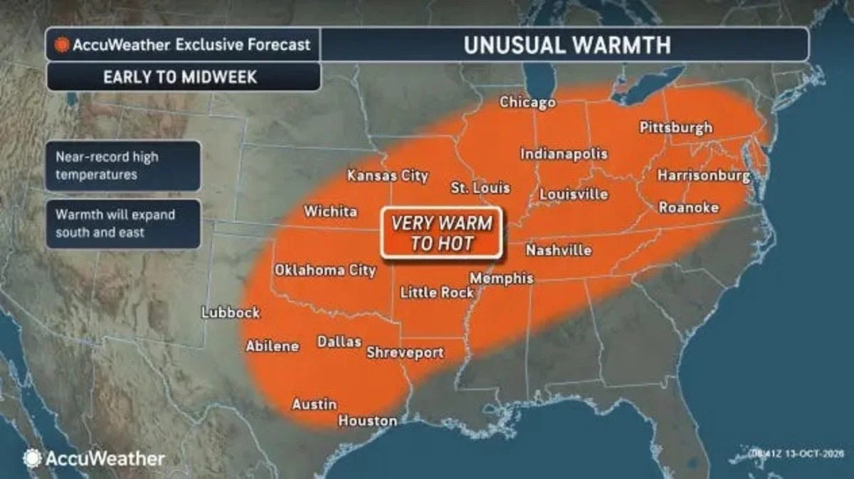
It’s mid-October, so wild temperature changes can be expected across the country. This week will be no exception.
A major, record-breaking warm-up followed by a bone-chilling cooldown across much of the central and eastern United States will create a “weather whiplash” effect, one that could even end with light lake-effect snow across parts of New York and New England, according to an online forecast from AccuWeather.
October is well-known for fast temperature swings as leftover summer warmth crashes with colder air spilling south out of Canada, allowing potent fronts to send temperatures soaring or plunging in a just a few days, according to the National Weather Service.
Record heat first
NOAA’s Weather Prediction Center said in an online forecast that “during the week, unseasonably warm weather is expected to expand across the central and eastern United States through Thursday (Oct. 15), with high temperatures reaching the 90s and threatening longstanding daily records.”
Record highs are forecast to stretch all across the central and eastern United States, with temperatures running about 20 degrees above average, according to Weather.com meteorologist Rod Shackelford in an online report.
AccuWeather predicts that daily high temperature records dating back more than 125 years could be challenged or broken in cities such as Chattanooga, Tennessee; Birmingham, Alabama; and St. Louis, Missouri, among others.

Unusual, near record-breaking heat is in the forecast this week for a large chunk of the central and eastern U.S.
Cold front on the way
A front will put an end to the summer-like warmth: “A powerful cold front is trying to loosen summer’s hold on the central Plains and Eastern U.S., and it will largely succeed,” Shackelford said.
The front will take its time as it moves across the country, he added, “but get ready to see some temperatures take a tumble by the weekend. Highs in the South will go from the 80s and 90s to the 60s and 70s.”
The Northeast and Great Lakes will see temperatures drop to the 50s and 60s, with some scattered highs in the 40s, Shackelford said.

A major cooldown is coming this weekend to the central and eastern U.S.
Some snow possible
Along with the colder temperatures, a storm arriving later this week is projected to plunge southward out of Canada, pulsing across the Great Lakes and into the Northeast, according to AccuWeather. While most locations from the Ohio Valley to New England will get rain and showers from this storm, the possibility remains for snowflakes to fly in the higher terrain of northern New York, Vermont, New Hampshire and Maine.
“Any snow that falls won’t amount to much and will only fall at the highest elevations this weekend. Mountain cabins and lakes in New York and northern Vermont could get snowflakes that can coat the grass,” said AccuWeather expert meteorologist Peyton Simmers in an e-mail to USA TODAY.
“Lake-effect rain is more likely for cities like Erie (Pennsylvania) and Buffalo, who won’t quite get cold enough to see their first snow,” Simmers said.
Doyle Rice is a national correspondent for USA TODAY, with a focus on weather and climate.
This article originally appeared on USA TODAY: Weather whiplash incoming: Record October heat could flip to first snow











Leave a Reply